Showing posts with label hiking. Show all posts

Singapore: Sungei Buloh Wetland Reserve

One of my favorite things to do is walk. This is something I had to have picked up from my grandmother, who would take me into downtown San Francisco as a child. She never could drive due to her eyesight, so we used SF's unreliable transit system to get around. But buses don't go down every street, and sometimes it's easier (and nicer) to just walk from A to B.

When I lived in San Francisco as an adult, I went out almost every day for a walk. I took a bus or the streetcar to somewhere I hadn't been or somewhere I enjoyed visiting before, and just walked. City walks remain my favorite, but I love getting out into nature, too.

For that, I probably have to thank my mom. My memories of visiting California's countryside involve her, going up into the mountains of Yosemite or out to the redwood forests north of the Bay Area. Most of my travel as a younger adult focused on cities, but I "discovered" all of the great state parks in Georgia which rekindled my interest in that which isn't man-made.

So when I travel I look for places to walk - both in the city and in the country. Singapore is pretty small so it doesn't have that much country, but there are some places to get out and see the wild.
 Sungei Buloh Wetland Reserve is up in the northern end of Singapore. After a short boardwalk stroll, you come to the Wetland Centre, with some information about the wetlands and wildlife found within.
 A bridge leads you into the wetlands loop trail, the only open trail at this time.
 It is from this bridge I saw a giant monitor lizard up in a tree! He had to have been about a meter long or more, resting up on that branch.
 Without even venturing onto the trail, I also saw plenty of birds and mudskippers.
 As for the trail itself, it mostly looks like you see above. It's wide and flat, suitable for more-rugged wheelchairs and strollers. And most of the view through the brush is of water.
 The loop trail takes you around some tidal ponds where migratory birds spend their winters.
 The site is right next to large open water spaces. The mounds seen in the mud are most likely from crabs.
 Unfortunately, I didn't see much fauna on the loop itself. But I enjoy the flora too, especially the ferns and trees growing out of the marsh.
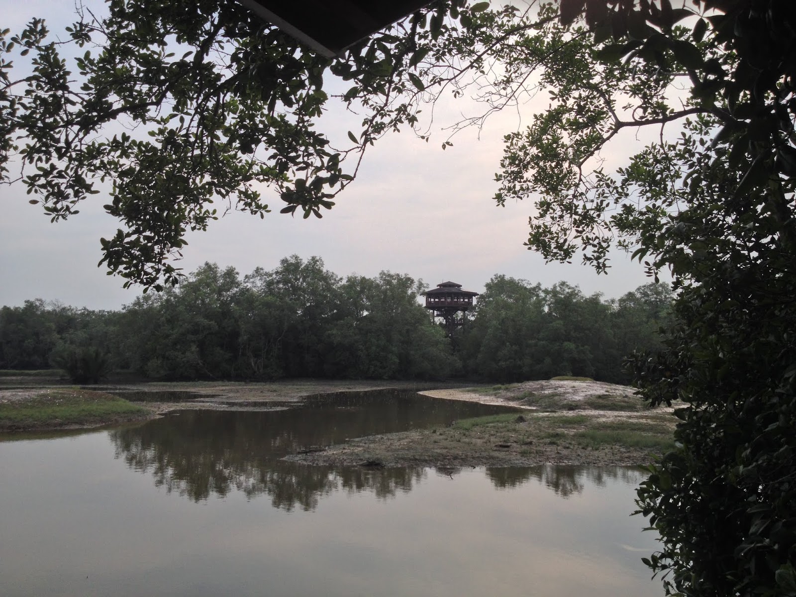
 Around the backside of the loop is a tower, visible in the left-hand picture. You can climb to the top and see the entire park. Also found along the loop are little blinds to allow visitors to view the wildlife without disturbing it. I should warn you that spiders, ants, and other creepy crawlies are found in some of these.
 Here are a couple views from above.

 Visiting right before the park closed, there were some stragglers including families on the trail, but the backside stayed mostly quiet. I visited on a weekend, so I'm guessing there were more people there than usual.

There is a new trail since my visit that heads east - actually, there is a new visitor's center on the eastern edge from which the new trail heads west to join with this original trail. If I get the chance, I'll definitely be checking out the new extension.
Buses are available from Kranji Station (route 925 or the less-frequent Kranji Express). The park is open 7 AM to 7 PM daily.

Hong Kong: The Peak Tram

 The Peak Tram began operation in 1888, carrying riders from downtown to the top of Victoria Peak. The trip is less than one mile each way, but has a height differential of 368 meters, or about a third of a mile up. The photo above is of Garden Road Station.
There are six stations in all, four along the route plus the two termini. At Garden Road Station, at the bottom of the hill, the waiting platform area has some old equipment on display.
 While none of the original cars exist from the early generations of tram vehicles, a replica of the first is on display.
 There are also cases with additional displays.
 The current cars are larger than the originals, but are designed to be reminiscent of the original system.
 The station at the peak is appropriately called The Peak, and there's an entire brand centered around the transportation system. Inside this building are shops and restaurants.
 Across the plaza, additional dining and shopping options are available. There's a convenience store over there as well.
 A fourth generation tram car is on display at the top, and it looks like it's possible to go inside at times. I arrived quite early and nothing was really open in the area.
 The weather in Hong Kong was foggy for most of my stay, so this is about the best you'll get of downtown.
 It's not that far away, but Kowloon is barely visible across the harbor.
 There really isn't that much to do at the top, especially early in the day, and with foggy weather there isn't much to see either. But you can walk up to the very top. Along the way, I came across a small park with some nice flowers and trees, called Mount Austin Road Playground.


 Instead of going to the park at the peak of Victoria Peak, I took a wrong turn. The stairs on the left were an okay shortcut, but I continued following the stairs on the right which led me to a private residence.
 This isn't that residence. This is a nice wall though outside one of the beautiful houses on the hill. I didn't make it to the peak, but given the weather Victoria Peak will be better visited on another trip.
 Back near the Peak tram station, there's a small overlook.
An hour of hiking wasn't long enough to clear the haze.
 These shots are across the harbor and I had to do a bit of processing to make them as clear as you see now.
The tram operates from 7 A.M. to midnight. Round trip tickets are HK$40 (about $5). Departures occur about once every 10-15 minutes.

Shikoku: Kashima Island

 Kashima Island is just 400 meters from Hojo, short enough to just swim across. The island itself is only 1.5 kilometers around, and has a few paths to provide a variety of hiking options.
 There is a ferry which will take you across in just a few minutes which runs about once every 20 minutes. The fee is only 200 yen round-trip. There are some snack shops and a restaurant built over the sea.
 Of course, there is a temple on the island near the ferry dock, but I arrived fairly late in the afternoon so it was closed. I'm not sure if/when the inside is actually opened.
 You can still walk around the grounds and take a peek inside.
 Being a small island, there is a bit of beach which has covered platforms good for parties and barbecues. Camping on the island is free, though I recall reading something that registration was required.
 There is an area on the beach designated for swimming, and the path around the island follows the water. (More on this later.)
 In addition to modern structures providing amenities for visitors on holiday, there are some historic sites with a bit of signage.
 Look closely and you'll see that there is some wildlife here, and in the mountain itself you'll find even more.
 This chain of rocks provides a nice foreground view to the rest of the inland sea and the mountains across the water.

Most visitors probably don't venture far into the island itself. The beach, shops, restaurant, pier, and a deer corral (?) can be found on the side of the island closest to Hojo.
 My plans on Kashima were to walk around the island and then to the top. Unfortunately, erosion of the waterside trail has closed it to the public for safety reasons. That didn't stop some people, and with more time I might have been tempted to see what could be found around the bend. But I still could head up the mountain.
 The hike up is quiet and pleasant. There are animals on the island; there are wild miniature deer that roam around but mostly stay hidden from tourists.
 There's a rest house on the way up, but I was a bit worried as I made my way through the forest that I'd get eaten alive by mosquitoes if I stopped. Bug spray, people. It's important in nature in Japan.
 I did stop for brief seconds to take a few pictures of interesting trees and the route up. There are a couple other paths leading up that might bring visitors to the backside of the island.
 The top has a TV transmission tower and an observation platform. At least the mosquitoes stayed away from the platform so I could get some photos.
 The chain of rocks is a religious site and the ropes are changed in a ceremony every year.
Ferries run from fairly early in the morning until late evening, but the schedule depends on the time of year. The shops on the island closed early, and I visited during vacation time. Hojo is a fairly large town and is served by express trains, and I understand that there's a supermarket within 10 minutes of the ferry pier, so it would be good to come to the island with everything you need (food, drinks, etc). Iyohojo Station is about a five minute walk from the pier.